A geological basin is a large low-lying area. It is often below sea level. Geological basins are one of the two most common places inland which collect sediment (the other is lakes). The type of rocks which form there tell about the palaeoclimate of the continent. The geology is of interest to oil prospectors, hydrologists and palaeontologists. - https://simple.wikipedia.org/wiki/Basin_(geology)
Sedimentary basins are regions of the Earth where long-term subsidence creates accommodation space for accumulation of sediments.[1] As the sediments are buried, they are subject to increasing pressure and begin the processes of compaction and lithification that transform them into sedimentary rock.[2] - https://en.wikipedia.org/wiki/Sedimentary_basin
The term ‘basin’ has different meanings depending on its location and containment. Groundwater basin is for aquifers; drainage basin delineates a river system; oceanic basin refers to the abyss; and sedimentary basin is a depression in the earth’s crust filled with sediments. https://www.geoexpro.com/articles/2019/05/geological-basin-classification
Sedimentary basins are areas in which sediment accumulated at a sig-nificantly greater rate than sediments of the same age in neighbouring areas, so accumulating a greater thickness. The sediments accumulate by virtue of subsidence. - https://www.sciencedirect.com/science/article/abs/pii/S0376736108700852
To define a basin, we follow the steps listed in the table below: (1) Define the outline of the basin and important regional structural features. (2) Map total sediment thickness. (3) Identify subbasins (depocenters and minibasins). (4) Map age and location of oil and gas fields. (5) Map age and location of source rocks. - https://wiki.aapg.org/Basin_framework
A basin is a depression, or dip, in the Earth’s surface - https://www.nationalgeographic.org/encyclopedia/basin/
Jadi cekungan adalah tentang:

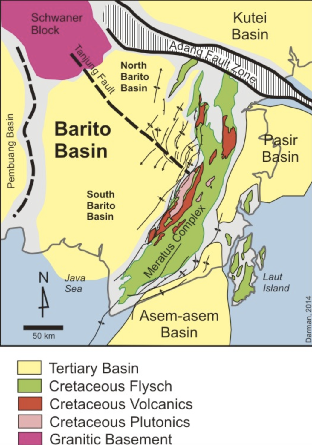
https://upload.wikimedia.org/wikipedia/commons/3/35/Geological-summary-map-Barito_Basin.jpg
https://upload.wikimedia.org/wikipedia/commons/1/1d/Geological_formations_(diagonal_center)_of_the_Big_Thicket_Basin_and_the_Epochs_in_which_they_were_formed_(lower_right)._This_is_a_generalized_illustration_and_it_is_not_accurate_in_scale_or_proportion.jpg